Search and filter territory map data
Inspect the rows behind the points without leaving the map builder.
When to use this
Use the Records table after importing CSV or Excel data, especially when you need to find one location, review zone assignment or export a smaller working view.
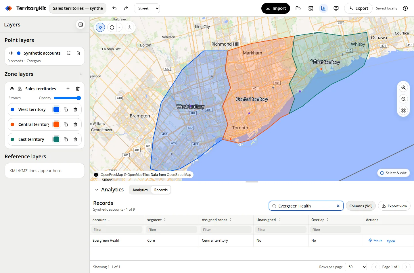
Step-by-step workflow
Open Records
Expand the bottom panel and choose the Records tab.
Search or filter
Use global search across every record field or type into an individual column filter.
Sort more than one column
Click a heading to sort; Shift+click adds a secondary sort.
Review membership
Assigned zones, Unassigned and Overlap populate from the selected point and zone layer analytics.
Focus or export
Focus a row on the map, open its point editor, or export the complete filtered and sorted view as CSV.
Supported formats and inputs
- Every imported point property becomes an optional table column.
- The full filtered view is exported, not only the current page.
- The table renders at most 250 rows per page and is tested with 50,000 synthetic rows.
Tips and common mistakes
- Hide columns you do not need before exporting a focused view.
- Wait for analytics to finish before relying on membership columns.
- Use Shift+click on headings for stable multi-column ordering.
Export and results
Filtered CSV export does not alter the original point layer or uploaded rows stored in the project.
FAQ
Can I export only matching rows?
Yes. Export view uses the current search, filters, sorting and visible columns.
Why are membership cells blank?
Choose the point and zone layers in Analytics and wait for the calculation to finish.
Can a table row locate the point?
Yes. Focus zooms the map to the point and opens its editor.
Related workflows
Build your first territory map
Bring your coordinates, draw the zones you need, and see the results as the map changes.
Open Map Builder