Fix CSV and Excel map import errors
Review and repair common coordinate problems before a CSV or Excel point layer is added to the map.
When to use this
Use the repair assistant when rows are skipped, coordinate columns are reversed, coordinates share one column or files use semicolon or tab delimiters.
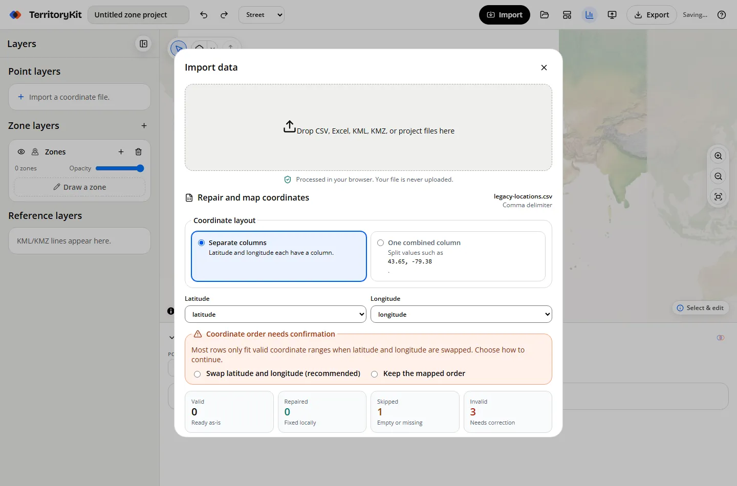
Step-by-step workflow
Import the file
Drop a CSV, XLSX or XLS file into the import window.
Confirm the layout
Choose separate latitude/longitude columns or one combined coordinate column.
Review the summary
Check valid, repaired, skipped and invalid counts before importing.
Confirm reversed coordinates
When most rows only fit after a swap, explicitly choose Swap latitude and longitude or keep the mapped order.
Download rejected rows
Save a CSV containing the original row plus a plain-language reason, correct it, and import again.
Supported formats and inputs
- CSV with comma, semicolon or tab delimiters.
- XLSX and legacy XLS workbook sheets.
- Combined values such as 43.65, -79.38 and decimal-comma values in semicolon files.
Tips and common mistakes
- Do not accept a coordinate swap unless the mapped locations make sense.
- Duplicate headers are kept by adding a numeric suffix instead of discarding a column.
- Empty rows are reported separately from invalid coordinate rows.
Export and results
Rejected-row downloads contain only the rows you supplied and the local validation reason. No file content is uploaded.
FAQ
Will TerritoryKit silently swap coordinates?
No. A likely reversal requires an explicit choice.
Can I import one coordinate column?
Yes, when each value contains a clear latitude and longitude pair.
Does the repair assistant geocode addresses?
No. It repairs coordinate formatting; it does not convert addresses to coordinates.
Related workflows
Build your first territory map
Bring your coordinates, draw the zones you need, and see the results as the map changes.
Open Map Builder