Migrate MapPoint territory data to TerritoryKit
Use open exported files as the bridge from a legacy MapPoint workflow to TerritoryKit.
When to use this
Use this guide when you can still export locations or boundaries from MapPoint, a saved report or an intermediate tool.
Step-by-step workflow
Export an open format
Export point rows as CSV or Excel with latitude and longitude, and export boundaries as KML when your available MapPoint workflow supports it.
Keep the original backup
Preserve the source files before cleaning column names or converting formats.
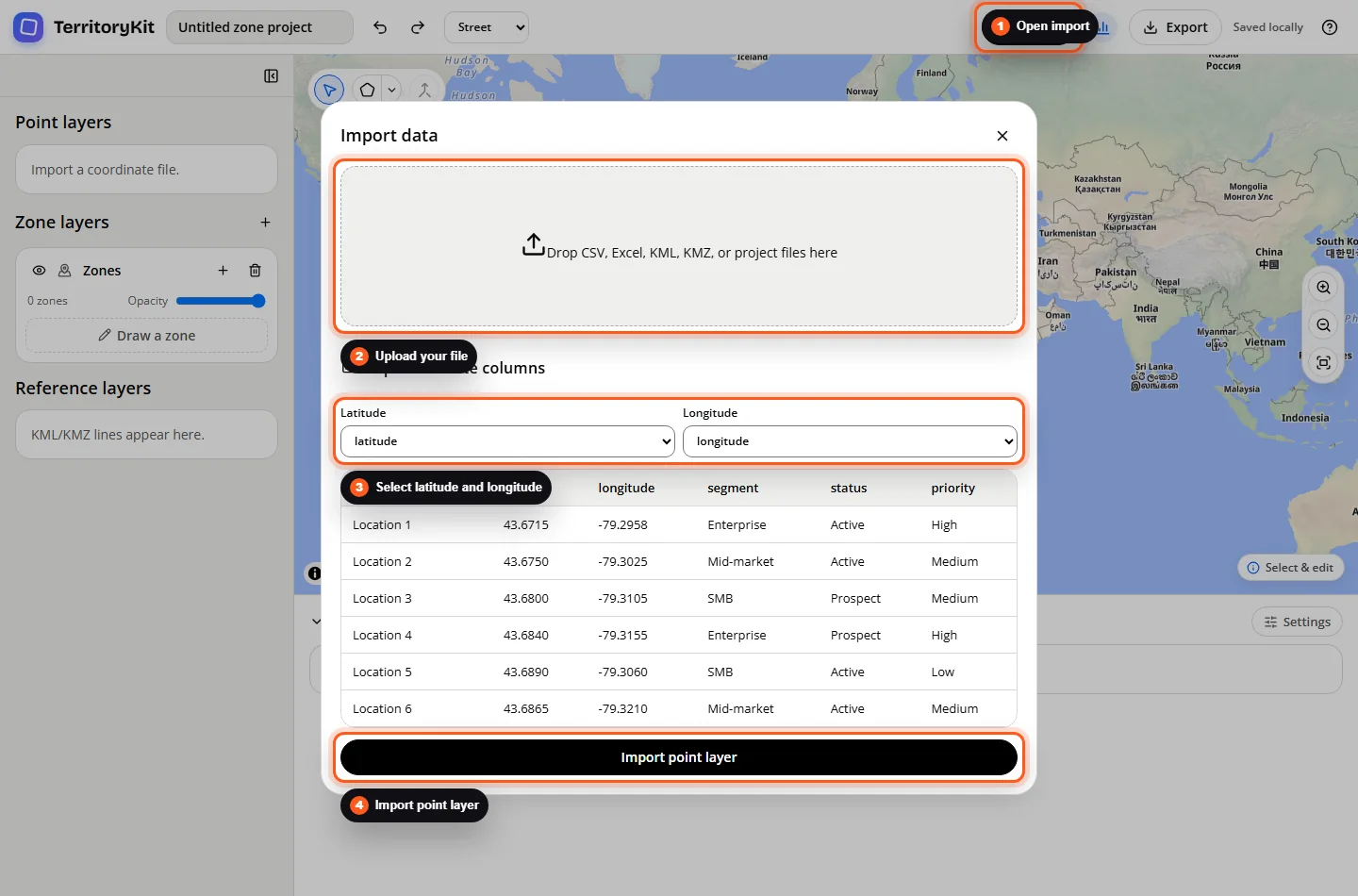
Import locations
Open TerritoryKit Import, choose the coordinate columns and review the repair summary.
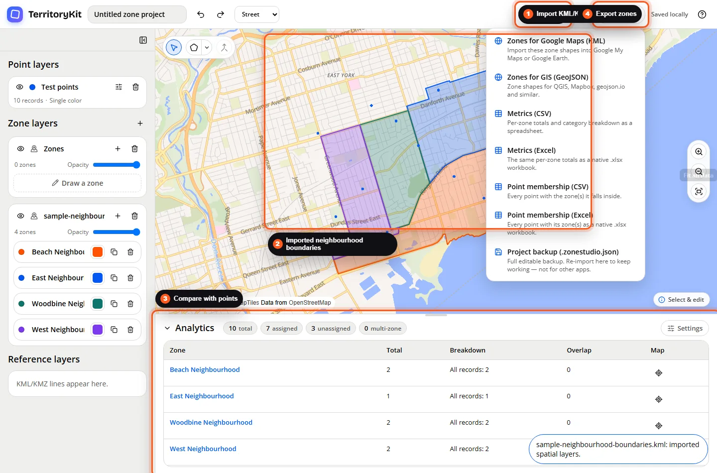
Import boundaries
Add KML or KMZ zones when you have a compatible boundary export.
Validate and save
Compare locations and zones, review unassigned records, then export a TerritoryKit project backup.
Supported formats and inputs
- Supported bridge formats: CSV, XLSX, XLS, KML and KMZ.
- Direct .ptm MapPoint project files are not supported.
- TerritoryKit does not decode proprietary MapPoint binary data.
Tips and common mistakes
- Check coordinate order and ranges after every legacy export.
- Use KML for polygon boundaries when available; spreadsheet rows alone do not recreate territory shapes.
- Treat automatic field suggestions as a starting point and verify the mapped result.
Export and results
After validation, save an editable TerritoryKit project and export open geometry or tables for downstream use.
FAQ
Can TerritoryKit open a .ptm file?
No. Export to CSV, Excel or KML through a tool that can still read the project.
Will a CSV contain my territory polygons?
Usually not. CSV is appropriate for point rows; use KML or another open geometry format for boundaries.
Is there a MapPoint preset?
Not yet. This guide documents the supported open-format workflow first while demand is measured.
Related workflows
Build your first territory map
Bring your coordinates, draw the zones you need, and see the results as the map changes.
Open Map Builder