Pharmaceutical sales territory design: map locations and workload
A territory with many nearby practices can require a different coverage plan from one with fewer hospitals spread across a large area. A useful map makes those differences visible. This guide shows a planning workflow using fictional account locations and explicit workload assumptions.
Choose the unit of coverage
Decide whether the plan assigns a practice location, hospital site, pharmacy or individual professional. A site and a person are not interchangeable: several professionals may share a location, and one person may work at several locations. Use stable site IDs and preserve the parent organization when the source has multiple branches.
Start with the business account-location fields needed for the planning decision. The fictional example uses sites, account type, coordinates, current territory and planned visit workload. It contains no patient records or real provider information.
Separate account eligibility from the map
Before drawing boundaries, decide which sites are in scope for this team and period. Keep a field for sites handled centrally, locations outside the team's remit and accounts that must retain a named owner. Use those rules consistently when comparing proposed territories.
A point inside a polygon establishes a geographic match. It does not establish that a site is eligible for a particular field activity or that ownership should change. Retain approved business rules alongside the geographic output.
Calculate the work you intend to cover
For an initial comparison, calculate annual planned visit hours = visits per year × minutes per visit ÷ 60. Keep frequency and duration visible rather than storing only the final total. That makes it easier to check why a large account needs more time.
| Site | Type | Visits/year | Minutes/visit | Annual hours |
|---|---|---|---|---|
| P001 | Practice | 12 | 30 | 6 |
| P002 | Practice | 12 | 45 | 9 |
| P003 | Specialist site | 6 | 40 | 4 |
| P004 | Hospital site | 4 | 90 | 6 |
| P005 | Pharmacy | 12 | 20 | 4 |
| P006 | Specialist site | 6 | 60 | 6 |
The six sample sites total 35 scheduled visit hours per year. The sample's Urban territory contains the first three sites and totals 19 hours; Regional contains the last three and totals 16. Both have three sites, but the visit workload differs.
These frequencies and durations are invented to demonstrate the calculation. They are not recommended coverage standards. Add your own travel, preparation, administration and access assumptions before comparing the workload with a rep's available capacity.
Build the map from the same account list
- Import the coordinate-ready CSV or Excel account-site list.
- Check the location preview and resolve rejected or misplaced records.
- Keep named-account exceptions separate from the geographic coverage pool.
- Draw territory boundaries or start with supported administrative boundaries.
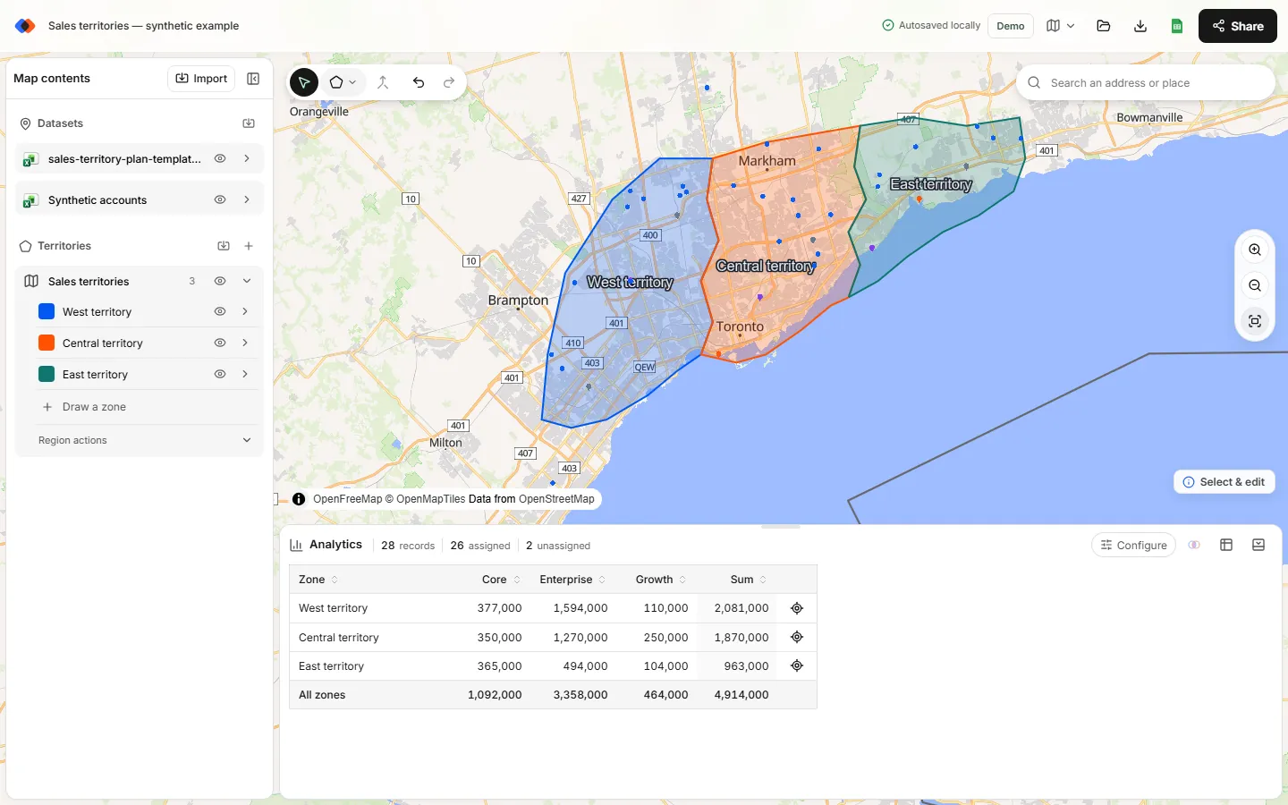
- Select the site dataset and territory layer in Analytics.
- Compare account counts, then use Sum of the annual visit-hours column.
- Break down by account type to inspect the mix of practices, hospitals and other sites.
The downloadable sample is ready to plot, but it does not include boundary polygons. Its existing territory labels are source assignments. Draw your own practice plan, then compare geographic matches with those labels.
Review exceptions before changing owners
Export point membership and match it back to the source by site ID. Review sites outside every boundary, sites in overlapping areas, and sites whose proposed geographic territory differs from the current assignment. For each exception, record the proposed owner, reason, reviewer and effective date.
Keep geography and ownership in separate columns until the review is complete. A hospital group handled by a central account team may sit inside a field territory without belonging to that rep. Removing those rows from the geographic allocation pool, while retaining a separate overview layer, can make the totals easier to interpret.
Compare scenarios on a stable baseline
Keep the same eligible sites and workload assumptions while comparing two boundary proposals. Otherwise, a revised visit frequency can look like an improvement caused by a boundary move. Save each scenario with a clear name and retain its membership export.
Choose the design using both total workload and operational context. A lower variance in visit hours is useful only if the resulting territories are workable. Check continuity of ownership, neighboring coverage, appointment constraints and the practical handover of accounts.
After the approved change, compare actual work with the assumptions that shaped the plan. Revise a documented input when it is wrong; do not infer that a territory is balanced simply because its polygon looks similar in size to the next one.
What TerritoryKit contributes
TerritoryKit supports location imports, editable boundaries, numeric sums, account-type breakdowns and membership exports. It can help you inspect a proposed coverage plan. It does not automatically optimize pharmaceutical territories, supply provider lists, recommend visit frequency or synchronize account ownership with a CRM. Exports require sign-in and use your plan allowance.
FAQ
Should pharmaceutical territories contain the same number of accounts?
Not necessarily. Compare the workload and account mix as well as count. The six-site example has equal counts but different scheduled visit hours.
Does the sample contain real provider information?
No. The names, site types, planning values and location records are fictional practice data.
Can the map calculate travel time between visits?
TerritoryKit does not calculate routes or travel times. Use your operating information to evaluate those constraints separately from the map's geographic analysis.
Does TerritoryKit assign accounts to reps automatically?
It calculates geographic territory matches and exports them for review. You decide ownership, exceptions and effective dates.
Related guides
Build your first territory map
Bring your account list, draw the territories you need, and see the results as the map changes. Your first map is free.
Open Map Builder