What data do you need for sales territory planning?
A territory plan can look balanced while its input table counts the same customer twice or mixes annual and monthly figures. Prepare the account list before drawing borders. This checklist separates what you need to place records on a map from what you need to make an assignment decision.
Start with one row per account location
Decide what a row represents: a customer, a store, an office or a service site. For geographic planning, one row per physical location is often the clearest starting point. A customer with three locations then has one stable customer ID and three distinct site IDs. Keep the parent relationship so three sites do not become three separate customers in a management report.
Use the same definition in your source export, mapped points and final assignment table. Counting orders in one territory and customer sites in another produces numbers that cannot be compared.
The sample contains six invented account locations around Denver. It is coordinate-ready practice data, not information about real businesses. Replace its names, values and coordinates before using the structure for your plan.
The fields to collect
| Field | Purpose | Check before mapping |
|---|---|---|
| Account and site IDs | Match records across exports and distinguish locations | Unique site IDs; stable parent account IDs |
| Latitude and longitude | Place each location on the map | Decimal degrees, correct order and plausible location |
| Current territory and owner | Compare geography with existing responsibility | Consistent names; explicit blank or unassigned values |
| Segment and status | Compare account mix and choose eligible records | One documented definition per category |
| Annual potential and revenue | Separate estimated opportunity from actual business | Same currency and time basis; missing is not zero |
| Visit frequency and duration | Estimate coverage workload | Use one period and include the units in the heading |
| Source date | Show when the input was last checked | One known snapshot date or a clear date per record |
TerritoryKit needs usable location data to plot points. It preserves other imported columns so they can support category breakdowns, numeric sums and exported reviews. The business meaning of potential, account status and ownership remains yours to define.
Choose the location method
Coordinates: retain decimal latitude and longitude in separate columns. Check several locations on the map, especially those near a territory boundary. A valid numeric coordinate can still point to the wrong city.
US street addresses: TerritoryKit can match up to 1,000 addresses per import through the Census workflow after you allow the address transfer. Review non-exact, ambiguous and unmatched results. See address-to-coordinate preparation for the matching limits and review steps.
ZIP codes only: a representative ZIP coordinate can support a broad overview, but it cannot establish the exact site. Several accounts may appear at the same point. Use a ZIP-based workflow and retain the distinction when deciding assignments.
Keep opportunity and effort separate
Current revenue describes existing business. Potential is an estimate whose definition must be documented. Workload describes the time needed to cover accounts. A territory with higher revenue does not necessarily have more remaining opportunity, and equal account counts do not establish equal workloads.
For the sample, annual visit hours equal visits_per_year × minutes_per_visit ÷ 60. This includes scheduled visit time only. Travel, preparation, administrative work and unsuccessful appointments need their own assumptions if you want a complete capacity estimate.
| Current territory | Account sites | Annual potential (USD) | Annual visit hours |
|---|---|---|---|
| North | 2 | 300,000 | 13 |
| Central | 2 | 240,000 | 14 |
| South | 2 | 270,000 | 14 |
| Total | 6 | 810,000 | 41 |
These are spreadsheet totals using the sample's existing territory column. They are not results from a supplied boundary file. After drawing your own boundaries, export membership and compare the geographic result with those existing assignments.
Run five data checks before designing
- Find duplicate site IDs. Resolve accidental duplicates before they inflate counts or sums. Keep legitimate multiple locations under separate site IDs.
- Inspect missing values. Blank revenue, zero revenue and “not applicable” mean different things. Decide which records qualify for each comparison.
- Normalize units. Convert to a common currency and period before summing. Do not add annual potential to monthly sales.
- Reconcile totals. Compare imported row counts and numeric totals with the source export, allowing for reviewed exclusions.
- Record exceptions. Mark house accounts, national accounts, vacant territories and locations that must stay with an existing owner.
Import, inspect and return assignments to the spreadsheet
Open the map builder, import the file and confirm the location columns. Review rejected rows before continuing. In Analytics, select the account dataset and the intended territory layer, then compare counts or the sum of a numeric column. Use a category breakdown to check the mix of accounts rather than relying on totals alone.
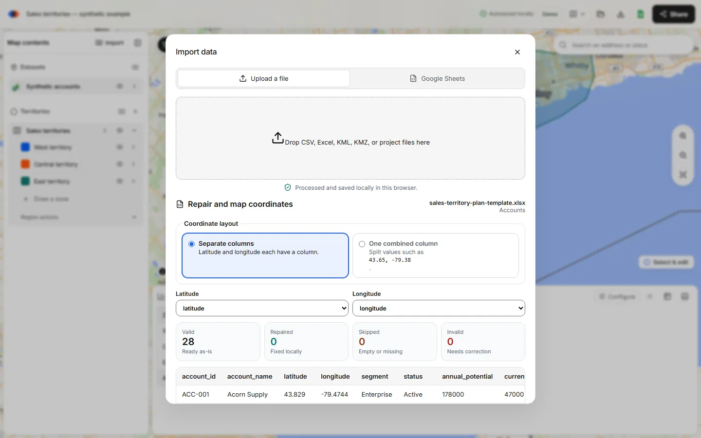
Export point membership when the boundaries are ready for review. Match results back to your source using the stable site ID, and investigate records with no territory or multiple territory matches. Exporting requires an account and uses the current plan allowance. Use the full planning workbook to add targets, ownership decisions and a change log.
FAQ
Do I need revenue data to start a territory map?
No. You can start with locations and account counts. Revenue, potential and workload improve the business comparison only when their definitions and coverage are reliable.
Should each customer have one row?
Use one row per unit you intend to map. For customers with multiple sites, separate site IDs and a parent account ID prevent location counts from being mistaken for customer counts.
Can I import addresses without coordinates?
For US street addresses, use the supported Census matching flow and review the results. For international locations, provide prepared latitude and longitude.
Is the sample ready to import?
Yes. It contains six fictional coordinate-ready records. Its territory labels are example source assignments, not a downloadable boundary plan.
Related guides
Build your first territory map
Bring your account list, draw the territories you need, and see the results as the map changes. Your first map is free.
Open Map Builder