Territory map checklist: from imported data to a useful export
A map can look finished while accounts are missing or counted twice. Use this checklist after drawing your territories and before handing a map, account list or coverage report to someone else.
1. Reconcile the imported rows
Start with the number of location rows in your source file. Review the import assistant's valid, repaired, skipped and invalid counts. A successful import does not mean every original row was usable. Keep rejected rows for correction and check that the final point count matches the rows you intended to map.
Use a stable account or site ID to identify duplicates. Two records at the same coordinate can be two legitimate accounts; two copies of the same account ID may be an import problem. Decide whether your unit is an account, a branch or an individual visit before removing repeated locations.
2. Check where the points landed
Inspect a few known locations at street level. Latitude must be between -90 and 90 and longitude between -180 and 180. Reversing the two values can still produce valid numbers, so range checks alone are not enough. Also check longitude signs and decimal separators.
Spreadsheet points need latitude and longitude. A ZIP-only list needs coordinates added first. If every account in a ZIP uses the same approximate ZIP coordinate, those accounts can appear stacked on one point. That is useful for a broad area summary, but it cannot distinguish locations on opposite sides of a custom boundary within that ZIP.
3. Review gaps and overlaps before adding totals
Choose the intended point dataset and territory layer in Analytics. Inspect unassigned records and multi-zone records. Use the Records table or a point-membership export to find the affected IDs. A multi-zone count can be correct for shared service coverage, but it needs a decision when every account should have one owner.
| Membership | Accounts |
|---|---|
| East only | 4 |
| West only | 3 |
| Both East and West | 2 |
| Neither territory | 1 |
East contains six accounts and West contains five. Adding them gives eleven memberships, although only nine distinct accounts are covered. Two of those nine are counted in both territories. If you need exclusive assignments, resolve those two overlaps and the one unassigned account before exporting an owner list.
Points exactly on a boundary are treated as inside. An account on a shared border may therefore appear in both adjacent territories even when the polygons look neatly joined.
4. Confirm what your numbers measure
Record counts, revenue, annual potential and weekly workload are different measures. Start with counts to reconcile coverage, then select Measure → Sum of for the numeric column you want to total. Check a few rows manually and keep the unit visible in the report.
Do not interpret a missing revenue value as a known zero. Review incomplete source fields before making comparisons. When categories are involved, standardize spelling so values such as Enterprise and enterprise do not fragment your breakdown. TerritoryKit provides the calculations; the meaning and completeness of your data remain part of the review.
5. Choose an export for the next person's task
| Next task | Export | Final check |
|---|---|---|
| Review a map in a meeting | PNG or print/PDF | Title, territory labels, legend and readable text |
| Assign individual accounts | Point membership CSV or Excel | Account IDs, zero matches and multiple matches |
| Compare territory totals | Metrics CSV or Excel | Selected measure, unit and category breakdown |
| Continue in a mapping tool | KML or GeoJSON | Expected territory names and shapes |
| Keep an editable backup | Portable project file | Correct project and a secure place to store the file |
A PNG explains the map visually but does not replace an account table. A membership table explains assignments but is not an editable project backup. Choose the result you need first, then export it.
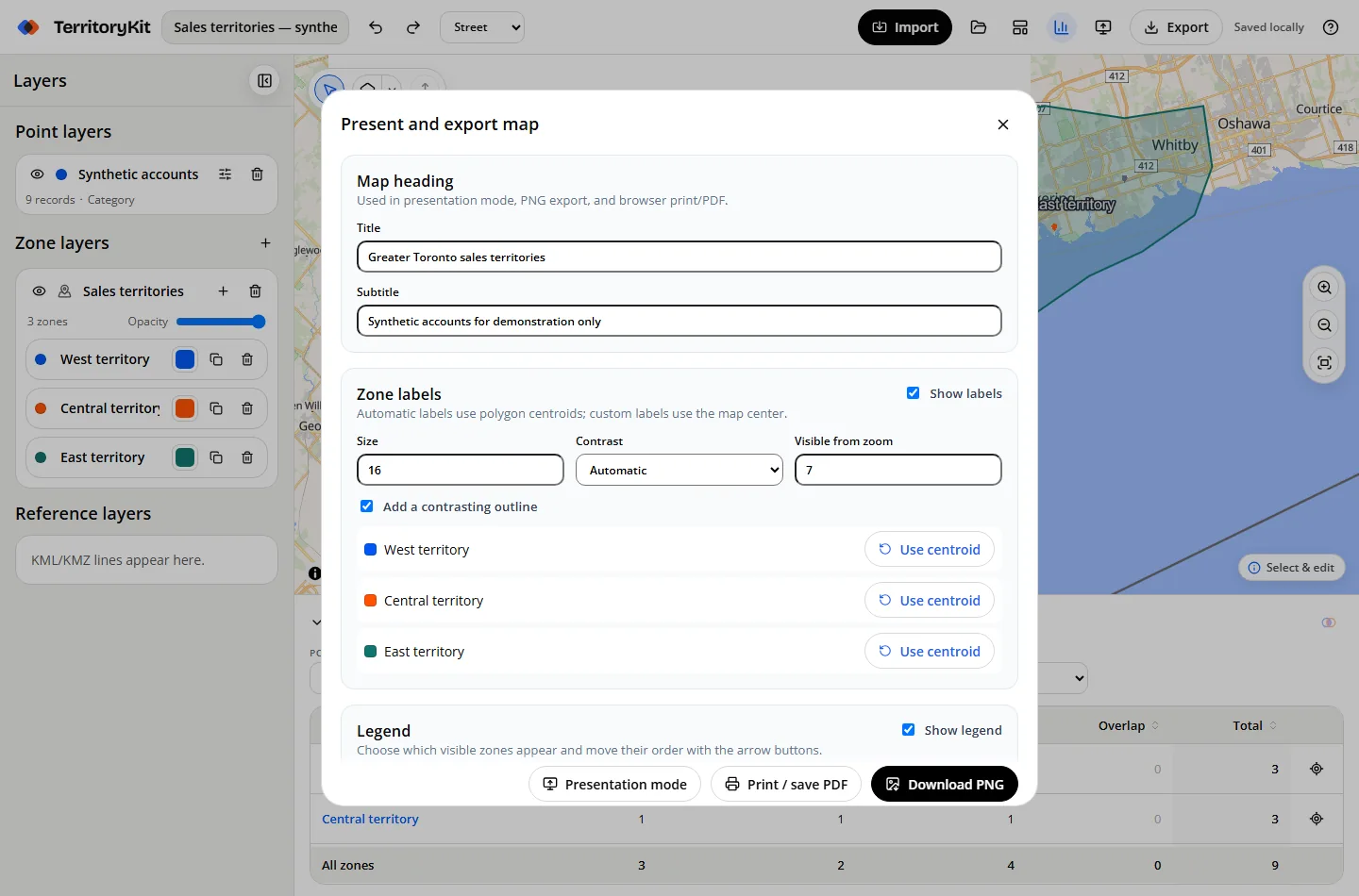
For a visual export, add a title, inspect the legend order and keep map attribution visible when a basemap is included. If the provider prevents tile capture, TerritoryKit can produce a geometry-only image. Review the downloaded file before sharing it; the basemap may differ from what you saw in the editor.
6. Save, share and confirm the handoff
You can explore and draw locally without signing in. Exports require an account. The free Demo account includes one owned map, ten total exports and 200 MB of storage. The ten exports do not reset monthly; a download, print/PDF action or Google Sheets results write uses the allowance. See current plan details before producing multiple versions.
For an internal review, sign in and share a saved map with named viewers, editors or admins. Sharing works through saved revisions, so coordinate who edits rather than assuming simultaneous live collaboration. For a file handoff, send the chosen export and record the review date, data source and outstanding exceptions.
Local autosave belongs to one browser profile. Save important work to your account or keep a portable backup before clearing site data or changing devices. Finally, open the exported file and verify that its record count, headings or visible territory labels match the result you intended.
FAQ
Why do my territory counts add up to more than my account total?
An account can fall inside multiple territories. Each matching territory counts it, including points on shared boundaries. Inspect point membership before treating the sum as unique coverage.
Can I export a map without an account?
You can map locally without an account, but exports require sign-in. Demo includes ten total exports; Pro provides unlimited export count subject to file and processing safeguards.
Should I export PNG or Excel?
Use PNG or PDF to present the map. Use point membership CSV or Excel when someone needs the accounts and their matching territories. For an editable backup, export the project file.
Does an unassigned account mean the import failed?
No. It can be a valid imported point outside every selected territory. Check the selected layers and its coordinates before deciding whether to extend a territory or record an exception.
Related guides
Build your first territory map
Bring your account list, draw the territories you need, and see the results as the map changes. Your first map is free.
Open Map Builder