How to make a 3-digit ZIP code map (ZIP3 territories)
A 3-digit ZIP code map groups every ZIP code by its first three digits, so the whole country fits into a few hundred areas instead of tens of thousands. That makes ZIP3 a practical building block for national sales territories, freight zones and distributor regions. This guide explains what a 3-digit ZIP prefix is, when to use one, and how to build ZIP3 territories with the 896 areas built into TerritoryKit.
Quick answer
To make a 3-digit ZIP code map, open the map builder and choose Territories → Add boundaries. Pick United States, choose 3-digit ZIP codes under Boundaries and set Territories from to 3-digit ZIPs. Check one or more states, or click a Census region chip, then select Add. Each prefix becomes a zone named like “ZIP 750” that you can merge into territories, label and export.
- 896 ZIP3 areas across 54 states and territories, grouped by state in the picker.
- Built from 2020 Census ZIP Code Tabulation Areas, grouped by their first three digits and simplified for planning.
- No 50-code limit. Unlike the 5-digit lookup, you can add a whole state, a region or the whole country in one step.
- Free to build without an account. Exports need sign-in.
What is a 3-digit ZIP code?
A five-digit ZIP code reads from broad to narrow. The first digit is one of ten national areas, from 0 in the Northeast to 9 on the Pacific coast. The first three digits, called the ZIP prefix or ZIP3, generally identify a USPS sectional center facility (SCF): the processing plant that sorts mail for the post offices around it. The last two digits point to a post office or delivery area within that prefix.
The Postal Service doesn't publish 3-digit ZIP boundaries, any more than it publishes 5-digit ones. TerritoryKit's set is built from the Census Bureau's 2020 ZCTAs: every ZCTA was grouped by its first three digits and dissolved into one shape. A ZIP3 area on the map is therefore the land covered by the ZIP areas that share that prefix, which approximates the SCF's service area. Prefixes with no 2020 ZCTA, such as military APO and FPO prefixes, don't appear. For background on ZCTAs, see where to get ZIP code boundary files.
When a 3-digit ZIP code map is the right choice
ZIP3 sits between states and 5-digit ZIPs. It's fine enough to follow metro areas and coarse enough that a national plan stays readable.
| Use case | Why ZIP3 works | Watch out for |
|---|---|---|
| National sales territories | About 900 building blocks instead of roughly 33,000 five-digit ZIP areas; easy to list in a contract or CRM rule | Too coarse inside a dense metro, where one prefix may need two reps |
| Freight and shipping zones | USPS postage zones are looked up by origin and destination prefix, and many freight rate tables list 3-digit prefixes | Your carrier's own prefix list decides the rate; the map is for planning |
| Distributor and dealer regions | Agreements are often written as lists of prefixes, which map one-to-one onto ZIP3 zones | Prefixes near state lines can serve addresses in two states |
| Direct mail and SCF planning | Mail is commonly presorted to SCFs, so prefix areas match how a campaign is prepared | Shapes approximate SCF areas; they aren't official service boundaries |
| A rep's city territory | Usually not the right level | Use 5-digit ZIPs instead; see the ZIP code map maker guide |
Many national teams use both levels: ZIP3 areas for regions and managers, 5-digit ZIPs for the few metros where reps share a prefix. Sales territory design covers how to choose building blocks.
How to build a 3-digit ZIP code map step by step
Open Add boundaries
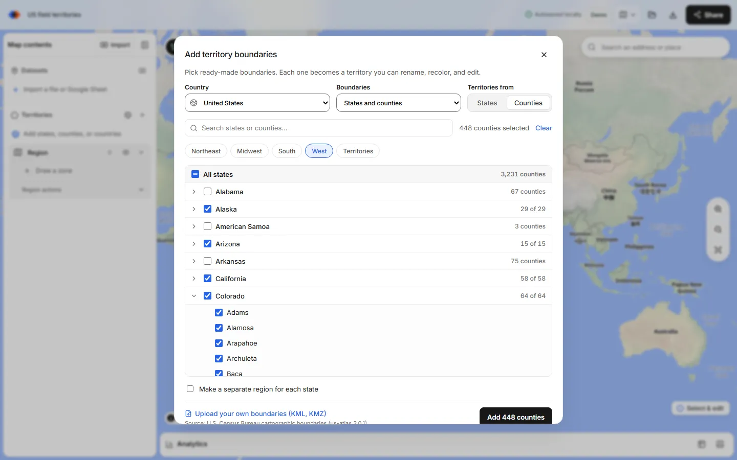
In the map builder, open the Territories panel and choose Add boundaries, the globe button. In the Add territory boundaries dialog, pick United States, then 3-digit ZIP codes under Boundaries. The set downloads once for the country; no file upload or account is needed.
Choose Territories from: 3-digit ZIPs
The switch offers States or 3-digit ZIPs. States adds whole state outlines; 3-digit ZIPs lists every prefix under its state.
Select prefixes
Check a state to select every prefix in it; Texas has 49. Expand the state to uncheck the ones you don't want. To select a whole part of the country, click a Census region chip: Northeast, Midwest, South, West or Territories. To find prefixes by number, type into the search box, for example “ZIP 75”, and use Select all matches.
Decide on one region or one per state
Leave Make a separate region for each state off to put every prefix in one region, which you need if territories cross state lines, because Merge selected zones works inside one region. Turn it on to get one region per state, such as “Texas 3-digit ZIPs” and “Oklahoma 3-digit ZIPs”.
Add the areas
Select the Add button, which shows the count, such as Add 49 3-digit ZIPs. Each prefix becomes its own zone in its own color, named “ZIP 750”, “ZIP 751” and so on.
Merge prefixes into territories
With the select tool, Ctrl-click (Cmd-click on a Mac) or Shift-click the prefixes for one territory and choose Merge selected zones. Rename the result, for example “North Texas”, and pick its color. Repeat for each territory.
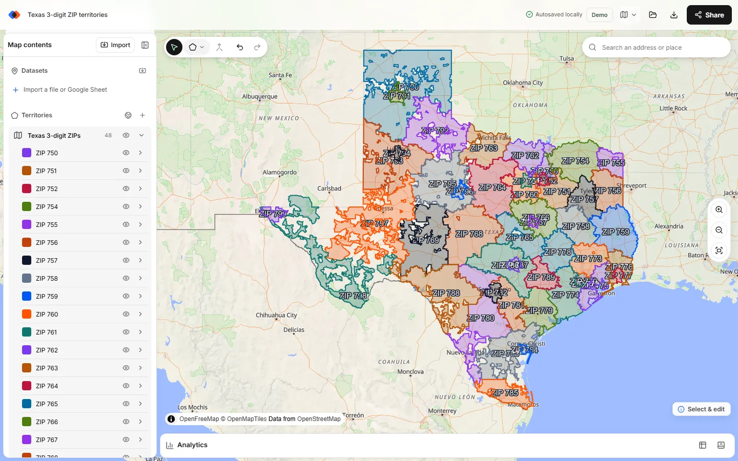
How ZIP3 areas are grouped by state and Census region
In the picker, each 3-digit area sits under one state, and the states sit under the four Census regions plus a Territories chip for Puerto Rico and other territories. The South chip, for instance, selects every prefix in 16 states and the District of Columbia. If your regions follow the Census map, the US sales regions map guide shows the region and division lists.
A few prefixes have ZIP areas on both sides of a state line. They're listed under one state, so check prefixes along borders before you finalize a state-based plan.
Splitting a prefix between two territories
Busy metro prefixes sometimes hold more accounts than one rep can serve. You have two options:
- Cut it. Select the ZIP3 zone, choose Line cut from the draw tools, draw a line that starts and ends outside the zone along a highway or river, and press Enter. Merge each piece into the territory that owns it.
- Use 5-digit ZIPs for that metro. Look up the metro's 5-digit ZIPs, up to 50 per lookup, as a separate region and use them as the territories there. Zones from different regions can't be merged together, so keep the metro as its own region.
Document any cut with the road or landmark it follows, so the rule still makes sense in a CRM that assigns by ZIP code.
Count accounts per 3-digit ZIP territory
Import your accounts as CSV, Excel or a Google Sheet. Rows with latitude and longitude plot directly; US street addresses can be matched during import with Find coordinates from addresses, up to 1,000 per import. Then open Analytics, choose the accounts under Dataset and your ZIP3 region under Territories. You get a count per territory, an optional breakdown by a category such as segment, and totals of a number column with Measure → Sum of. Accounts outside every territory show as unassigned, which usually means a prefix is missing from your plan.
TerritoryKit doesn't balance territories automatically. Compare the counts, move a prefix between territories by hand, and check again; how to balance sales territories walks through the method. To write the territory back to each account, export point membership as CSV or XLSX, as described in assign accounts to territories.
Export and reuse your ZIP3 territories
Sign in to export. A PNG or print/PDF suits slides and contracts; see export a territory map as PNG or PDF. The zones themselves export as GeoJSON or KML, so the same ZIP3 territories can go into a GIS tool or a web map; free GeoJSON boundaries covers the formats and the Census attribution. On the Demo plan each export uses one of 10 in total; Pro removes the limit.
Limits of 3-digit ZIP maps
- Approximate shapes. ZIP3 areas are dissolved 2020 ZCTAs, simplified for planning. They aren't survey-grade or official USPS boundaries.
- Prefixes change. USPS can reassign ZIP codes and open new ones; the Census set is updated with each decennial census.
- No value shading. TerritoryKit colors each zone individually; it doesn't shade prefixes by a number like a heat map.
- Large selections are slower. All 896 areas fit on one map, but the more zones a map holds, the slower it is to edit and save. Merge as you go.
FAQ
What is a 3-digit ZIP code map?
It's a map of the United States divided by the first three digits of ZIP codes. Each area covers every ZIP code that shares a prefix, which generally corresponds to a USPS sectional center facility's service area.
How many 3-digit ZIP codes are there?
TerritoryKit's built-in set has 896 areas: every prefix with land in the 2020 Census ZIP Code Tabulation Areas. Prefixes without a land area, such as military APO and FPO prefixes, aren't included.
What do the first three digits of a ZIP code mean?
The first digit is one of ten national areas. The first three digits together usually identify the sectional center facility that processes mail for that area. The last two digits identify a post office or delivery area.
Can I create sales territories from 3-digit ZIP codes for free?
Yes. Adding the ZIP3 areas, merging them into territories and counting accounts in Analytics works without an account. Exporting the map or files needs a free sign-in, with 10 exports on the Demo plan.
Can I download 3-digit ZIP boundaries as GeoJSON?
Yes. Add the prefixes you need, then choose Export → GeoJSON after signing in. Each export counts toward the Demo allowance. See free GeoJSON boundaries.
Can I mix 3-digit and 5-digit ZIP codes on one map?
Yes, as separate regions: ZIP3 areas for most of the plan and a 5-digit lookup for a metro that needs finer detail. Zones in different regions can't be merged together.
Related guides
Build your first territory map
Bring your account list, draw the territories you need, and see the results as the map changes. Your first map is free.
Open Map Builder