How to make an international sales territory map
Global teams rarely plan at one level. EMEA might be split by country, North America by state, and one busy market by district. This guide shows how to build that kind of international sales territory map in a browser from built-in boundaries, without downloading or converting a single file.
Quick answer: build an international sales territory map
To make an international sales territory map, open the map builder, go to Territories → Add boundaries and choose World. Check the countries each team owns (checking a continent checks every country in it), then add them. Each country becomes an editable territory named after the country. Select several and use Merge selected zones to form regions such as “DACH” or “Nordics”, then rename, recolor and export. For finer territories inside one market, add that country's states, provinces or districts the same way.
No account is needed to add boundaries or edit the map. Exports need a free sign-in.
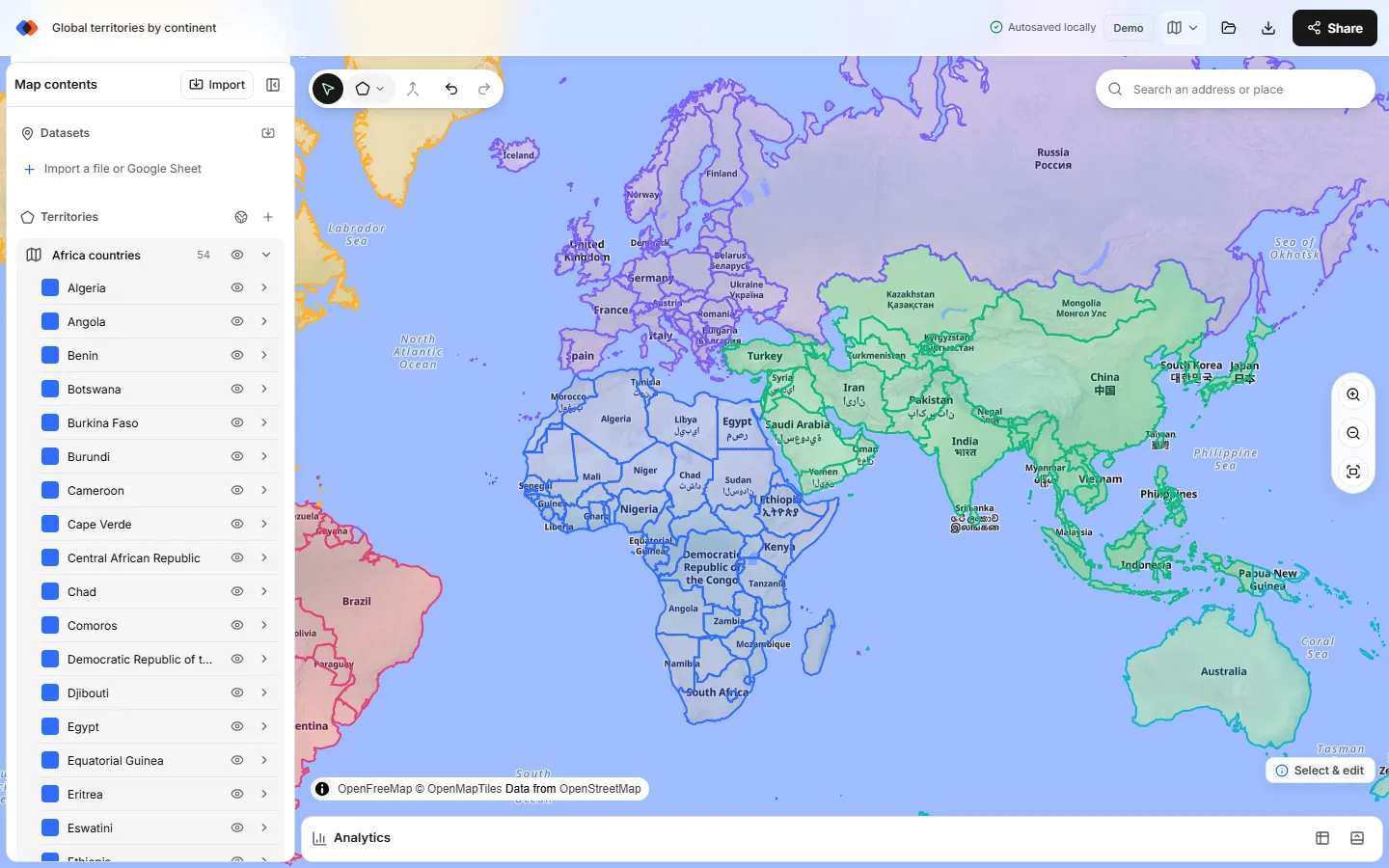
What the boundary library covers
TerritoryKit ships a boundary library for about 215 countries and territories. The detail available depends on the country:
| Level | What you get | Examples | Source |
|---|---|---|---|
| World | 242 countries and territories in 7 continents | Countries for EMEA, LATAM or APAC regions | Natural Earth 1:50m |
| States and provinces | First-level areas for every country | Brazilian states, Indian states, Canadian provinces | Natural Earth 1:10m admin-1, or national sources where listed |
| Districts and municipalities | Second-level areas for 16 featured countries and about 27 more | Germany's 401 Kreise, Spain's 8,205 municipalities, Japan's 1,724 municipalities, Mexico's 2,457 municipalities | geoBoundaries, Natural Earth, national statistics offices |
| Postal areas | Postal geography for three countries | 896 US 3-digit ZIP areas, 1,643 Canadian FSAs, 2,641 Australian postcodes | US Census, Statistics Canada, ABS |
The featured list at the top of the picker covers the United States, Canada, Mexico, the United Kingdom, Australia, Germany, France, Brazil, India, Spain, Italy, the Netherlands, Japan, Ireland, New Zealand and South Africa. Every other country is listed under its continent.
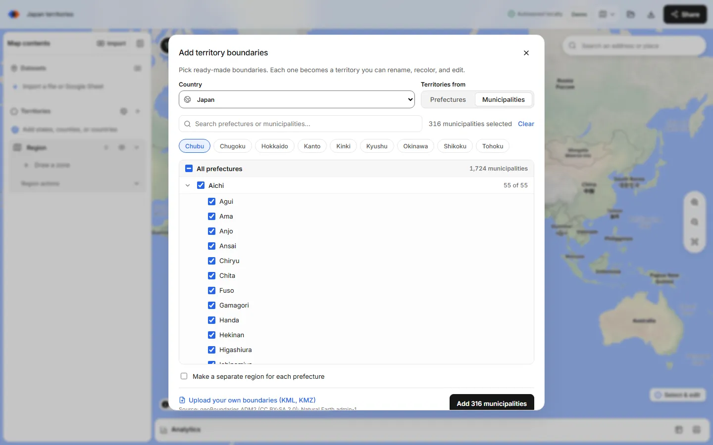
Make a world map by country, step by step
Open the boundary picker
In the map builder, open the Territories panel and choose the globe button, Add boundaries. The Add territory boundaries dialog opens.
Choose World
Pick World from the country list. Under Territories from, choose Countries for one territory per country, or Continents if you only need seven large regions.
Check the countries you sell into
Checking a continent checks every country inside it; uncheck the ones you don't cover. Use Search boundaries to find a country quickly, or type part of a name and choose Select all matches.
Decide on layers
Turn on Make a separate region for each continent to get one territory layer per continent instead of one large layer. Separate layers are easier to color, hide and analyze one region at a time.
Add and review
Choose Add. The map zooms to the new territories. Each country is a zone you can rename, recolor or reshape.
Merge countries into sales regions
Select the countries for one region (Ctrl-click or Shift-click; Cmd-click on a Mac) and choose Merge selected zones. Rename the result, for example “Benelux”, and give it a color.
That's the whole workflow for a world map by country. A map of 30 to 60 countries takes a few minutes; most of the time goes into deciding who owns what.
Go deeper inside a country
Most international plans have at least one market split more finely. Pick that country in the same dialog instead of World. Where a country has more than one boundary set, a Boundaries menu appears, and Territories from switches between the first level (states, provinces, regions) and the second level (counties, districts, municipalities or postal areas).
- Check a state to check every area inside it, then uncheck the exceptions.
- Quick-pick chips select whole regions, such as Spain's autonomous communities or Japan's regions.
- Namesakes keep their state. Two municipalities with the same name are labelled with their state, for example “Benito Juárez, Quintana Roo”, so you can tell them apart in labels and exports.
- Make a separate region for each state (or province, or region) creates one layer per state.
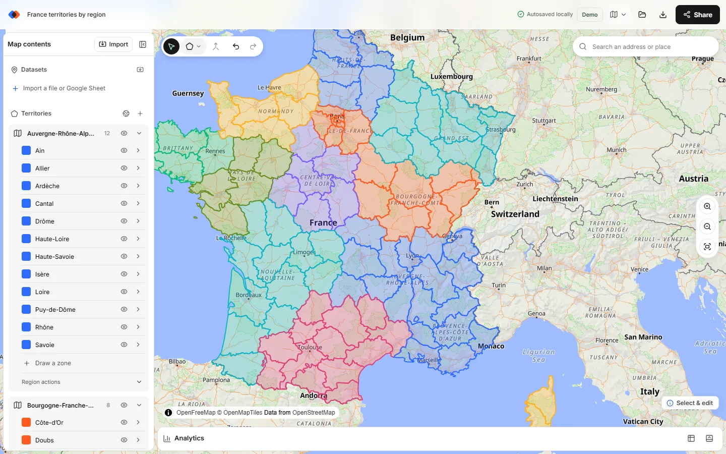
Country-by-country details, including which levels exist for each market, are in the Europe sales territory map guide, the UK sales territory map guide and the US sales regions guide.
Mix levels in one global plan
A typical global territory map uses different building blocks per region: countries for EMEA, US states for North America, and prefectures for Japan. Add each set with its own Add boundaries run. They all sit on one map.
Know how layers behave before you design around them:
- Each run creates its own layer. Countries from World and states from the United States end up in separate territory layers.
- Merging works inside one layer. You can merge German Kreise with each other, but not a German district with a US state.
- Analytics reads one territory layer at a time. Pick the layer under Territories in Analytics, check its counts, then switch to the next. For a single global table, export the metrics for each layer and combine them in a spreadsheet.
- Large selections are slower. Thousands of municipalities make the map heavier to edit and save. Add the areas you plan, not every unit in a country.
Name and merge territories that make sense
Boundary names come from the source data, so a country may appear under its short English name and a district under its local name. Rename merged territories to the names your team uses, such as “Iberia” or “Rep 4 · Bavaria”. Short names read better as map labels and become column values in exports.
Two behaviors are worth knowing:
- Countries that don't touch can't become one shape. Merging Ireland with Portugal, or a mainland with islands, produces one zone per separate piece, named “Name merged 1”, “Name merged 2” and so on. Give the pieces the same territory name and color.
- Line cut splits an area. If one country or state is too big for one rep, select it, choose Line cut, draw a line across it and press Enter. Rename both halves.
Add a legend and labels so readers can match colors to owners; see labels and legends for territory maps. For the rules behind a good split, such as balanced workload and clear borders, read sales territory design.
Add accounts and check coverage
A territory map earns its keep when you can see the accounts inside it. Import a CSV or Excel file with latitude and longitude columns; the CSV latitude and longitude guide covers column setup. Built-in address matching covers US addresses only (up to 1,000 per import), so international accounts need coordinates before import.
Then open Analytics, choose your accounts under Dataset and a territory layer under Territories. TerritoryKit counts the accounts in each territory, sums a numeric column such as revenue (Measure → Sum of), breaks totals down by a category such as segment, and lists accounts that fall in no territory or in two. Unassigned accounts in a global plan usually mean a country was left unchecked; overlaps usually mean a hand-drawn area crosses a boundary. The overlapping territories guide shows how to resolve both.
Export and share the global map
Choose Export and pick what the audience needs: a PNG or print/PDF for slides, metrics or point membership as CSV or Excel, or the territories themselves as KML or GeoJSON for other tools. If GIS colleagues want the boundaries as data, the free GeoJSON boundaries guide explains the file and its licences.
Exports and cloud saving need a sign-in with Google or an email code. The free Demo plan includes one owned map and 10 exports in total; Pro costs US$19 per month or US$190 per year for unlimited maps and exports. Sharing the live map with named viewers, editors or admins is free on both plans. Editors work on saved revisions, not simultaneous live editing.
Limits to plan around
- No postal areas for most countries. UK postcode areas and districts, German PLZ and Dutch PC4 areas are not included. Use regions, local authorities, Kreise or municipalities instead, or import your own KML or KMZ boundaries.
- No international address matching. Prepare coordinates for accounts outside the United States.
- No automatic balancing or routing. TerritoryKit doesn't optimize territories, plan routes or draw drive-time areas. You adjust borders by hand while watching the counts.
- No CRM sync. Export point membership to update owners in your CRM.
FAQ
How do I make a world map of sales territories by country?
In TerritoryKit, choose Territories → Add boundaries, pick World, check the countries you cover and add them. Each country becomes a territory you can merge into regions, rename and color.
Can I combine countries and US states on one territory map?
Yes. Add world countries in one run and US states in another. They appear as separate territory layers on the same map. Merging works within a layer, and Analytics reports one layer at a time.
Which countries have district or municipality boundaries?
Sixteen featured countries, including Germany, Spain, Mexico, Brazil, India and Japan, plus about 27 more such as Austria, Poland, Turkey, Colombia, Indonesia and Nigeria. Every other country has states or provinces.
Is there a free country border maker for custom regions?
TerritoryKit lets you add country boundaries and merge them into custom regions in the browser without an account. Exporting the result needs a free sign-in; the Demo plan includes 10 exports.
Are the international boundaries official?
No. They come from Natural Earth, geoBoundaries and national statistics offices, simplified for planning. Disputed borders follow the source's approach, which may differ from a government's official map.
Can TerritoryKit geocode international addresses?
No. Address matching covers US addresses only. For accounts elsewhere, add latitude and longitude columns before importing; see addresses to latitude and longitude.
Related guides
Build your first territory map
Bring your account list, draw the territories you need, and see the results as the map changes. Your first map is free.
Open Map Builder